The 10 best levada walks in Madeira: routes, fees and easy options
Pedro Silva · 24 min read · Updated 26/Aug/2026
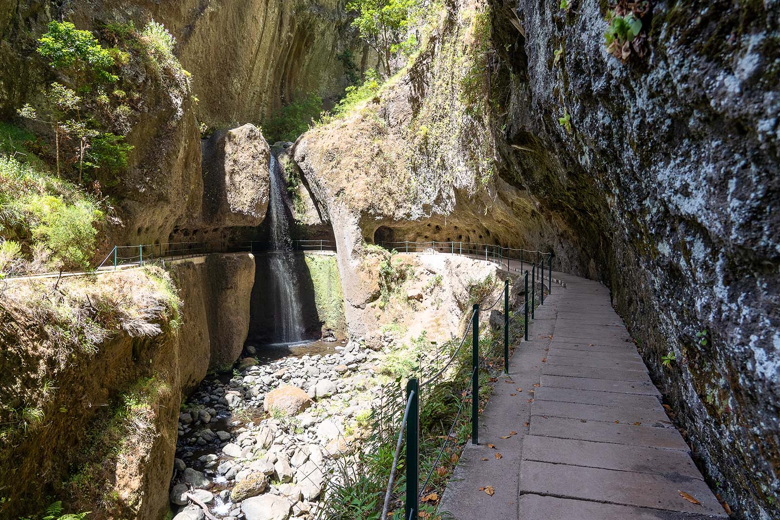
The best levada walks in Madeira, from 25 Fontes to Caldeirão Verde, with difficulty, timing, trail fees and booking, and first-hand notes on when to walk each one.
Madeira levada walks at a glance
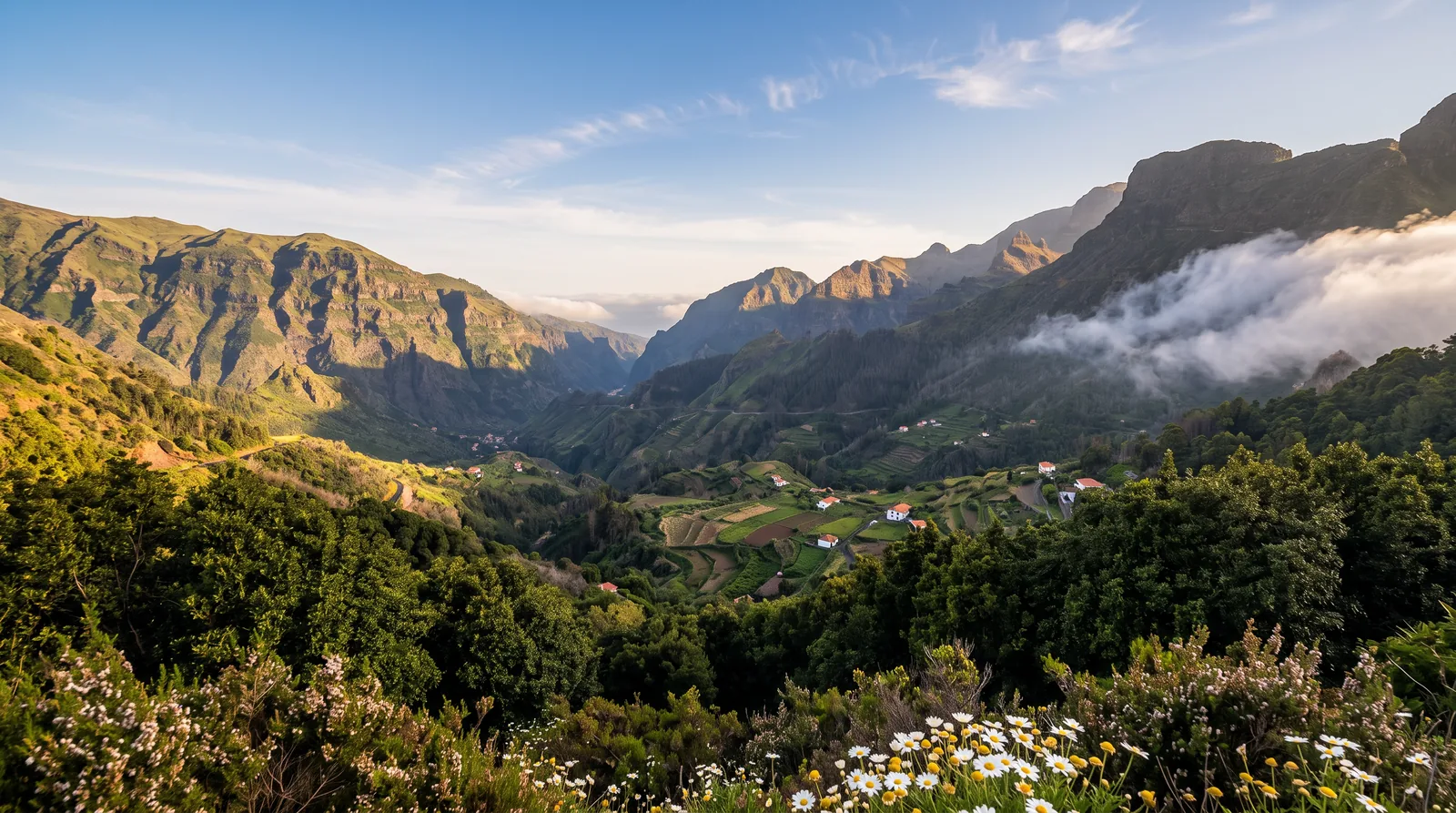
A levada is an irrigation channel that carries water from the wet north of the island to the dry south, and the maintenance path beside it is the trail you walk. That is why levada walks are mostly level: the channel has to follow the contour line. Only a minority of them are classified walking routes with a PR number: of the roughly forty PR trails in the official network, about a dozen are levadas. Since 1 January 2026 a classified route means a fee and a booked slot.
Before the list, a word about how I know these routes. I have walked these routes between 2019 and 2025, several of them more than once: 25 Fontes, Risco and Rabaçal in July 2019, Caldeirão Verde in August 2020, Balcões in August 2021, Caniçal in August 2022, Ponta do Sol in April 2022, Levada do Norte in August 2023, Faial to Ribeiro Frio in April 2024 and the Levada do Moinho in July 2025. Repeating routes taught me the most useful thing I can tell you here: the same levada is not the same walk twice. Conditions change with the season, the weather and even the hour, and a trail I have walked in fog felt like a completely different place when I came back under a clear sky.
The ten walks in this guide, easiest first. Distances and official times come from the trail sheets of the regional tourism board.
- Vereda dos Balcões: 3 km return, 1.5 h, easy, Ribeiro Frio, PR11.
- Levada do Risco: 3 km return, 2 h, easy, Rabaçal, PR6.1.
- Levada do Alecrim: 7 km return, 2.5 h, easy, Rabaçal, PR6.2.
- Levada do Caniçal: out and back as far as you choose, easy, Machico, unclassified.
- Levada do Moinho and Levada Nova: 9 to 11 km loop, 3 to 3.5 h, easy to moderate, Ponta do Sol, unclassified.
- Levada dos Cedros: 7.2 km one way, 3 h, moderate, Fanal, PR14.
- Levada das 25 Fontes: 8.6 km return, 3 h, moderate, Rabaçal, PR6.
- Levada do Rei: 10.6 km return, 3.5 h, moderate, São Jorge, PR18.
- Levada do Furado: 11 km one way, 5 h, moderate, Ribeiro Frio, PR10.
- Levada do Caldeirão Verde: about 13 km return to the waterfall, 5 to 5.5 h, moderate with long dark tunnels, Queimadas, PR9.
Eight of the ten are classified trails, so each needs a timed slot booked on SIMplifica and costs €4.50 per adult as of mid-2026. Any trail can close after storms, and one of these, the Furado, was shut from December 2025 until July 2026. Details in the fee section below.
The 10 best levada walks in Madeira
1. Levada das 25 Fontes (PR6): the island's waterfall classic
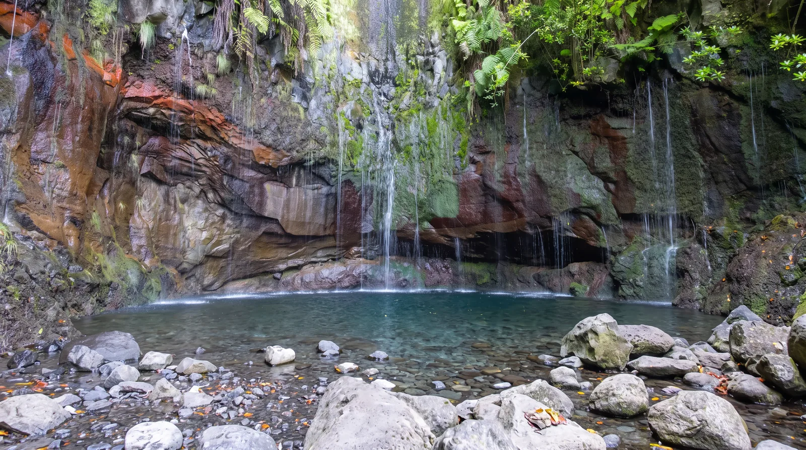
The walk people mean when they say levada walk. From the Rabaçal forest house the path drops into the laurissilva and follows the channel west, level for most of its length, with steps and damp rock in the last stretch. It ends in an amphitheatre of dark basalt where dozens of thin springs drip down the wall into one pool.
What I would tell a friend. I walked this one in July 2019, and my advice is not to race to the waterfall. Plenty of people almost jog it, photograph the wall of springs and turn straight back, and they miss most of what they came for: the laurel forest, the water running beside you, the small changes in the landscape. And go early. Not only for the parking, but because walking a levada nearly alone, with the sound of the water and the forest, is a completely different experience from walking it among dozens of people.
- Trail: PR6, classified.
- Distance and time: 4.3 km each way, 8.6 km return, 3 hours official.
- Altitude: 964 m to 1,288 m on the official sheet, most of it on the paved access below the forest house.
- Difficulty: moderate. Steps and wet rock near the springs.
- Start and parking: Rabaçal, E.R. 105, on the Paúl da Serra plateau (map).
- Fee and booking: €4.50, timed SIMplifica slot required.
- Best for: first-time visitors who want the single most photographed levada.
- Watch out: the pool is a bottleneck. From mid-morning you queue for the photograph.
2. Levada do Caldeirão Verde (PR9): tunnels to a hidden cauldron
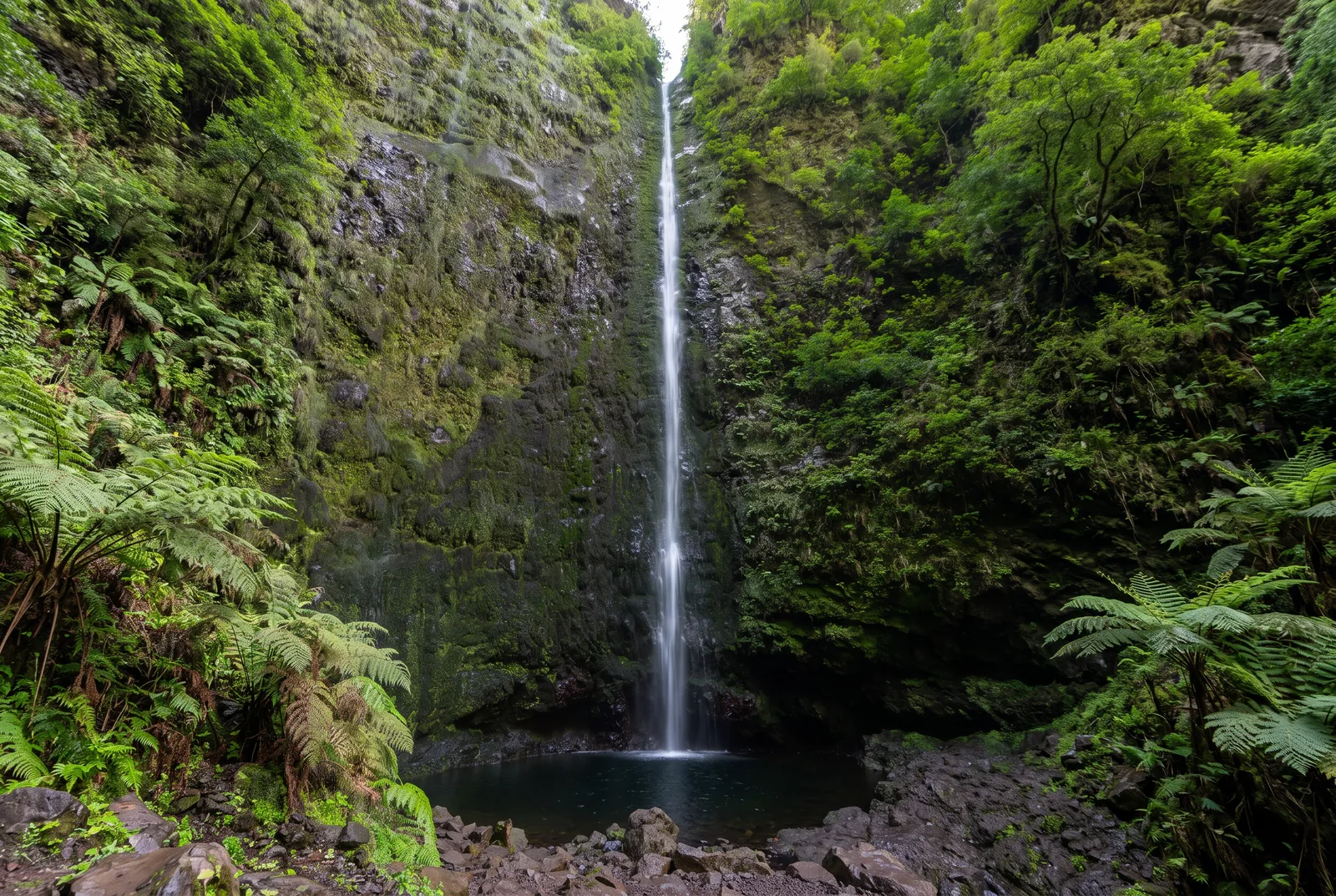
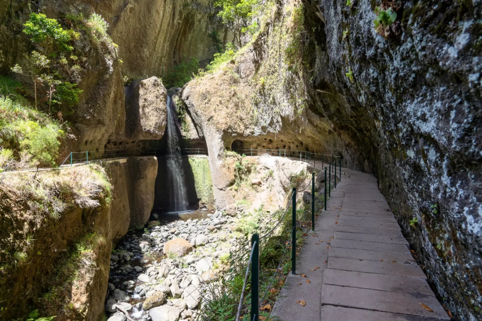
The longest walk here, and the one that feels least like a small island. From Queimadas Forest Park above Santana the levada threads along ledges cut into near vertical walls and through unlit tunnels, the longest a few hundred metres of dripping rock. The effort here is distance, not climb. The end is a waterfall dropping into a green basin.
What struck me here, on a walk in August 2020, was the sense of isolation on certain stretches. The tunnels, the very dense vegetation and the near-vertical mountain walls make you forget you are on a relatively small island. This is one of those routes where the way there is as interesting as the destination, which is worth knowing before you decide how fast to walk it.
- Trail: PR9, classified.
- Distance and time: 6.5 km each way to Caldeirão Verde, about 13 km return in 5 to 5.5 hours. The official sheet's 8.7 km each way, 17.4 km return and 6.5 hours cover the full route on to Caldeirão do Inferno.
- Altitude: 872 m to 1,020 m on the official sheet, almost level for the whole length.
- Difficulty: moderate, on length and exposure rather than gradient.
- Start and parking: Queimadas Forest Park, small paid car park, €2 an hour (map).
- Fee and booking: €4.50, timed SIMplifica slot required.
- Best for: walkers with a full day and no fear of the dark.
- Watch out: no light in the tunnels and unfenced drops beside the channel. A headlamp is equipment, not a convenience.
3. Levada do Rei (PR18): laurel forest with almost no gradient
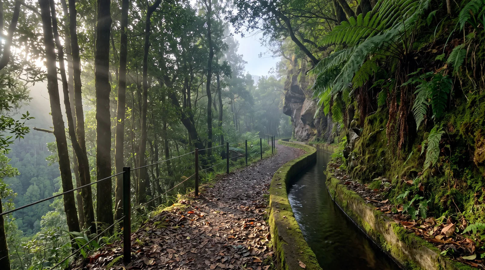
The flattest of the long walks. The channel runs from the São Jorge water treatment plant to the Ribeiro Bonito spring through unbroken laurel forest, and the official sheet gives a range of just 38 metres, 535 m to 573 m, across 5.3 kilometres. No viewpoint, no big reveal: the interest is continuous, ferns, moss and small side cascades. Short tunnels near the end need a light.
- Trail: PR18, classified.
- Distance and time: 5.3 km each way, 10.6 km return, 3.5 hours official.
- Altitude: 535 m to 573 m on the official sheet, the flattest long walk here.
- Difficulty: moderate on the official sheet, easy in practice for anyone used to walking.
- Start and parking: São Jorge, north coast, roadside spaces at the treatment plant (map).
- Fee and booking: €4.50, timed SIMplifica slot required.
- Best for: a first long levada, and for families with walking experience.
- Watch out: the ground stays wet for days after rain and the path narrows where the channel meets rock.
4. Levada do Alecrim (PR6.2): the quiet Rabaçal alternative
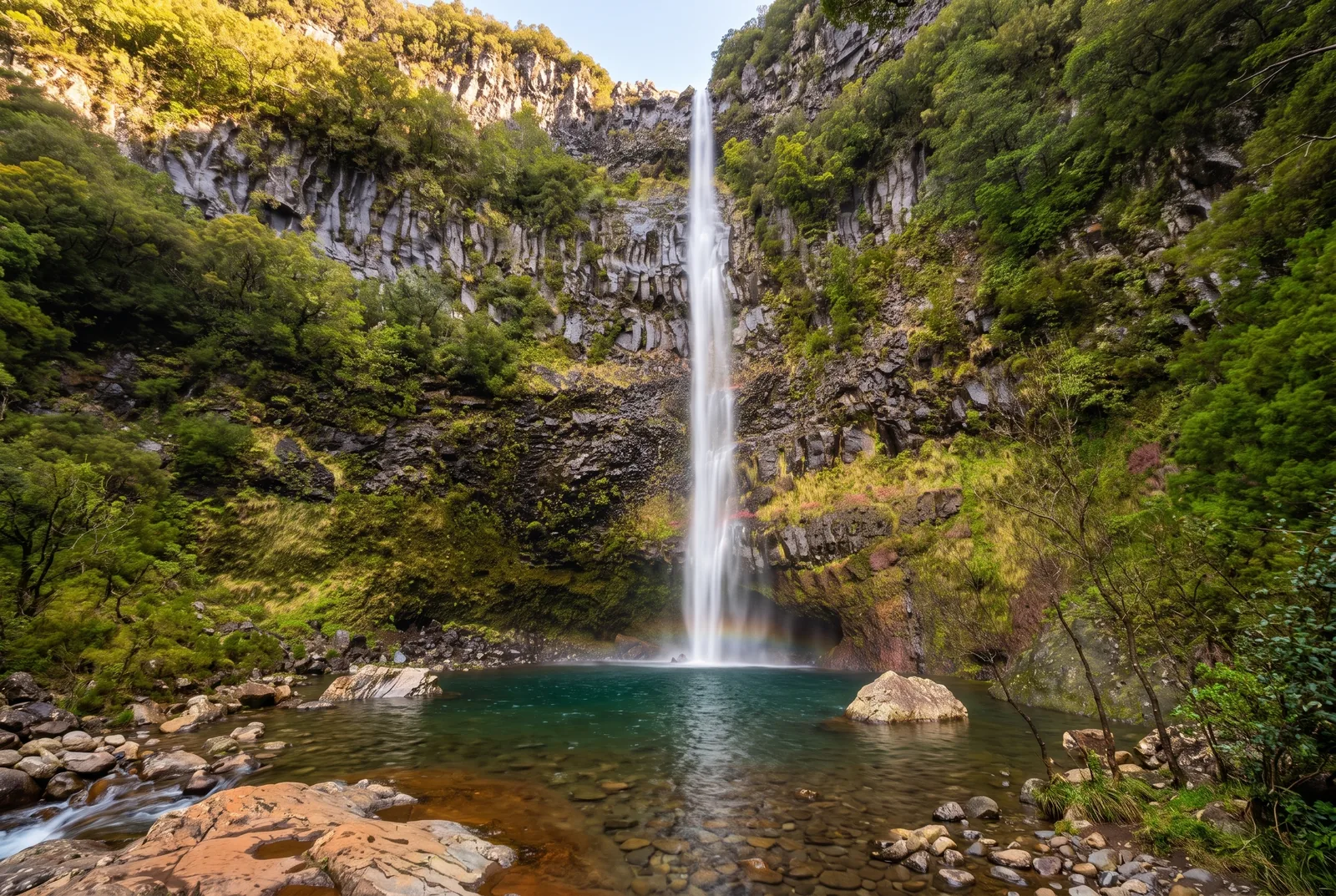
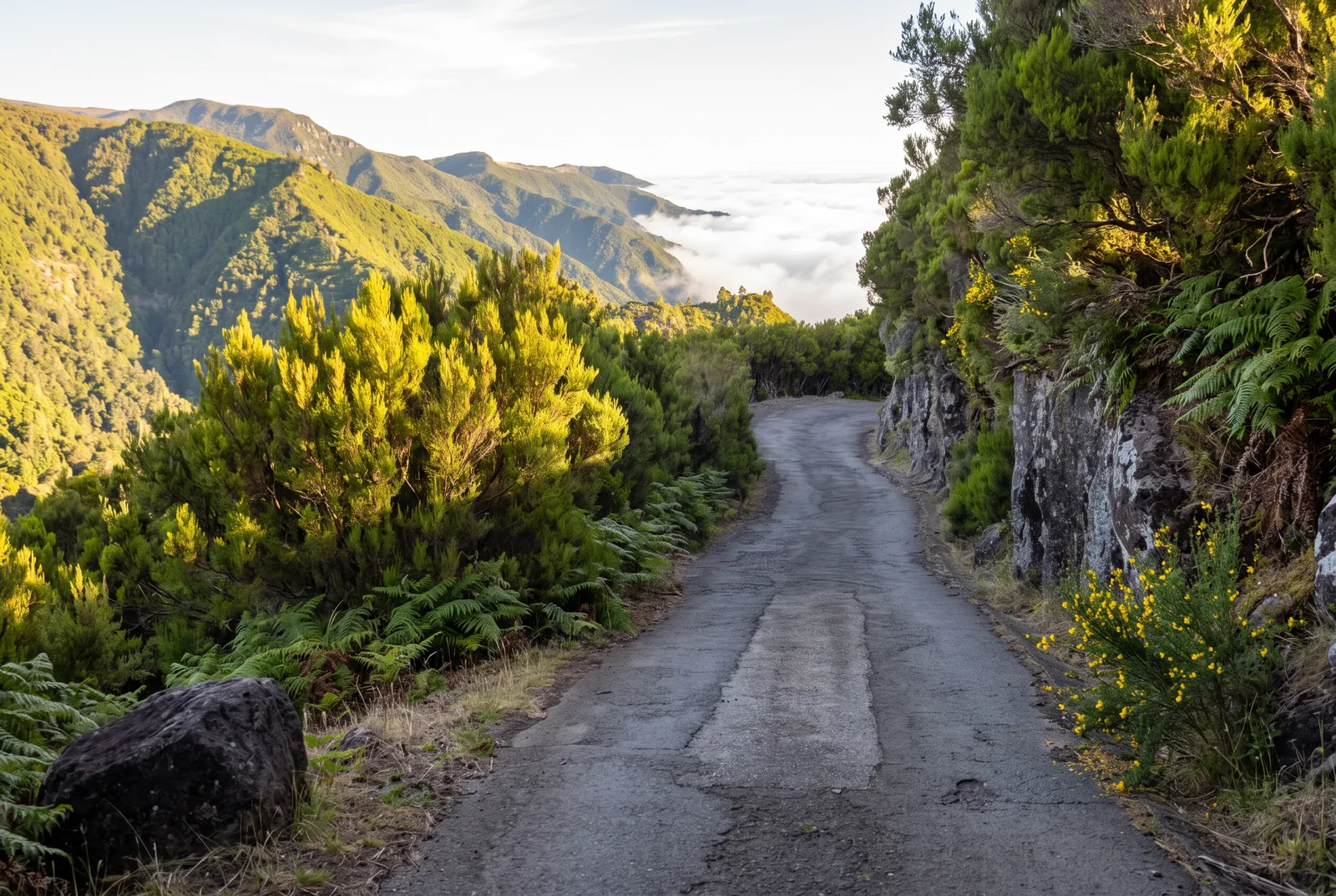
The same trailhead as 25 Fontes and a fraction of the traffic. The Alecrim runs across the high plateau, the highest walk of the ten, through open heather and short forest passages to the Lagoa Dona Beja pool. From there a marked descent continues to the Lagoa do Vento waterfall, which adds an hour and a steep reclimb. The plateau air is cold and the fog arrives without warning.
- Trail: PR6.2, classified.
- Distance and time: 3.5 km each way, 7 km return, 2.5 hours official.
- Altitude: 1,256 m to 1,339 m on the official sheet, the highest walk of the ten.
- Difficulty: easy on the official sheet. The Lagoa do Vento extension is not.
- Start and parking: Rabaçal, E.R. 105, same plateau car park and shuttle as 25 Fontes (map).
- Fee and booking: €4.50, a separate SIMplifica slot from 25 Fontes and Risco.
- Best for: a Rabaçal day that avoids the crowd at the springs.
- Watch out: Paúl da Serra makes its own weather. Take a windproof layer even in July.
5. Vereda dos Balcões (PR11): the easiest big view on the island
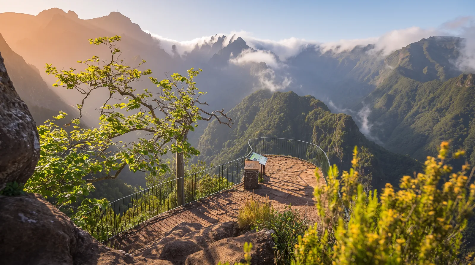
Not a levada but a vereda, a footpath, and the quickest classified walk in this guide. A wide, almost flat track leaves the road at Ribeiro Frio and reaches the Balcões terrace in 1.5 kilometres, with 10 metres of altitude difference between start and finish. The terrace looks straight up the Ribeira da Metade valley to the central peaks.
One honest warning, from an August 2021 visit. The walk is short and easy and the view can be extraordinary: on a clear day it is the best way to grasp the scale of the mountains in Madeira's interior. But there is no guarantee of a view at all. The weather up there turns very quickly, and you can arrive on an apparently perfect day and find everything under cloud. Treat the view as the bonus and the walk as the plan.
- Trail: PR11, classified.
- Distance and time: 1.5 km each way, 3 km return, 1.5 hours official.
- Altitude: 870 m to 880 m on the official sheet, in effect flat.
- Difficulty: easy, on a wide and even path.
- Start and parking: Ribeiro Frio, E.R. 103, a handful of roadside spaces shared with the Furado (map).
- Fee and booking: €4.50, the same as the long routes. Book before you drive up.
- Best for: a first day on the island, or a half day when the forecast is unstable.
If the terrace leaves you wanting more panoramas, our guide to Madeira's best viewpoints maps the island's finest.
6. Levada do Furado (PR10): the long forest crossing
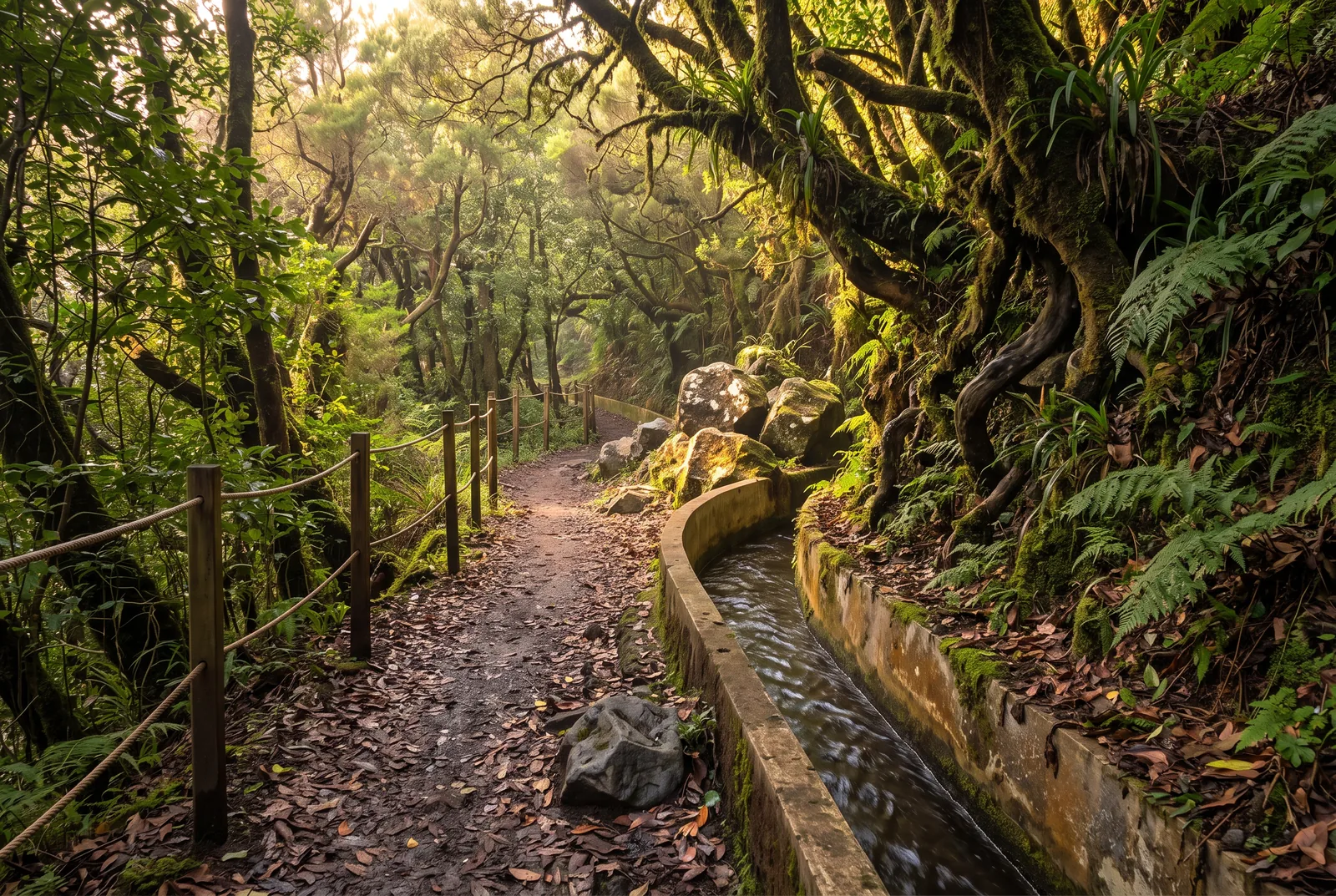
A point to point rather than an out and back. The levada leaves Ribeiro Frio at 880 m and descends gradually to Portela at 645 m over 11 kilometres, through cool, dripping forest, with wooden walkways bolted to the rock where the ledge runs out. The drop on the valley side is continuous and in places the handrail is a cable.
- Trail: PR10, classified.
- Distance and time: 11 km one way, about 5 hours official.
- Altitude: 880 m down to 645 m, a net descent of 235 m walked in one direction.
- Difficulty: moderate, on length and exposure.
- Start and parking: Ribeiro Frio, on the E.R. 103, finishing at Portela on the E.R. 102; the official sheet numbers the Ribeiro Frio access as E.R. 303 (map).
- Fee and booking: €4.50, timed SIMplifica slot required.
- Best for: walkers who want a half day in forest and can organise a pickup.
- Watch out: this valley takes the brunt of winter storms. Check the status page the morning you go.
A landslide destroyed the walkways in December 2025 and closed the route for months. It reopened on 14 July 2026 and the official page now lists it as open. Most people arrange a taxi at Portela rather than walk back uphill, and Balcões, from the same hamlet, is the obvious fallback.
7. Levada do Moinho and Levada Nova (Ponta do Sol): the sunny south loop
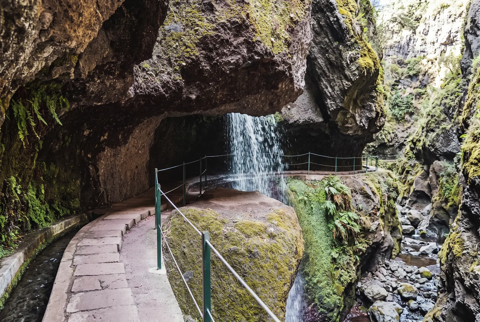
Two channels stacked on the same hillside above Ponta do Sol, walked as a loop with a climb between them. Terraced country, banana plots, vines and open sea light, not rainforest, the sensible choice on a day when cloud sits on the mountains. The Levada Nova section passes directly behind a waterfall that lands on the path, so you will get wet. Some stretches are narrow, with a drop and no railing.
- Trail: unclassified. The PR7 in the official network is a different Levada do Moinho, in the northwest, listed as closed as of mid-2026.
- Distance and time: 9 to 11 km loop, 3 to 3.5 hours depending on the variant.
- Altitude: low hillside above the village, one sustained climb between the two channels; no official sheet.
- Difficulty: easy to moderate, with one sustained climb between the two levadas.
- Start and parking: park in Ponta do Sol village and start on foot; there is no single official trailhead (map).
- Fee and booking: none as of mid-2026.
- Best for: sea views, village atmosphere, and any day the interior is clouded in.
- Watch out: little shade, and no fee means no ranger. Carry more water than you think.
8. Levada do Risco (PR6.1): a waterfall in twenty minutes
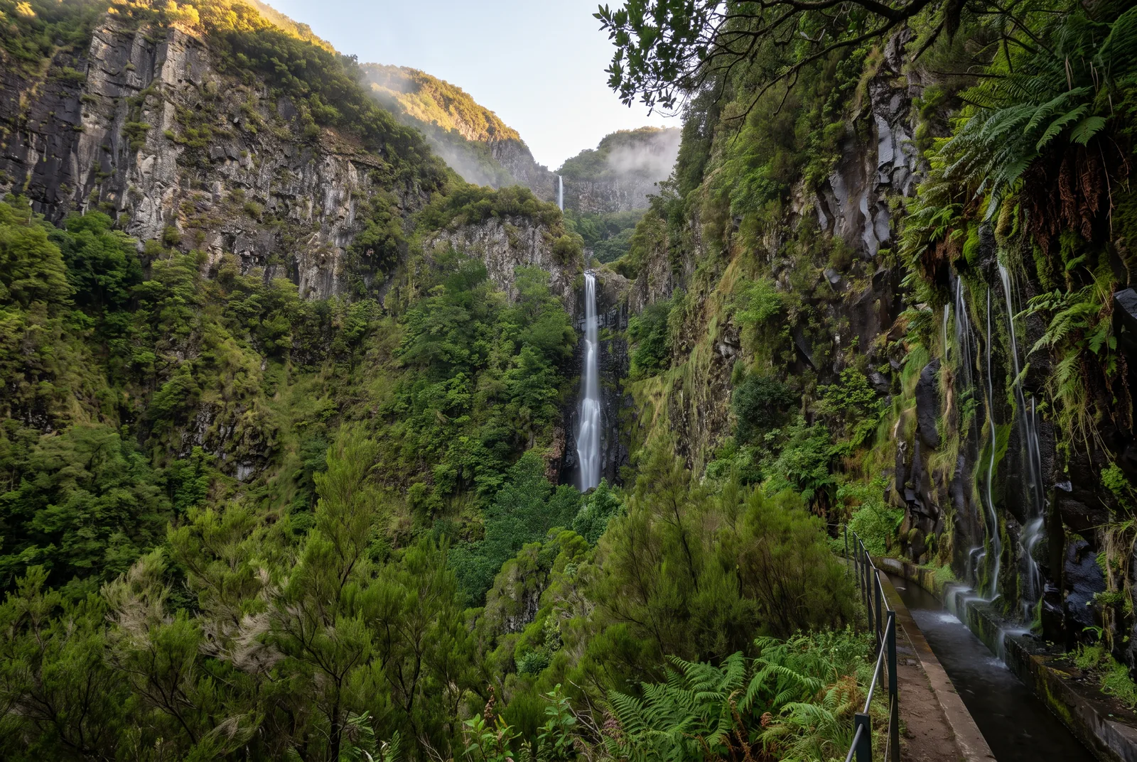
The easiest add-on decision on the island if you are already at Rabaçal. From the forest house a broad, level path follows the channel for 1.5 kilometres to a balcony facing the Risco waterfall, a thin veil sliding down a dark wall into the gorge. The official estimate is two hours return; many are back inside the hour. Do it before 25 Fontes and you get the balcony to yourself.
- Trail: PR6.1, classified.
- Distance and time: 1.5 km each way, 3 km return, 2 hours official.
- Altitude: 1,000 m to 1,288 m on the official sheet, the levada stretch itself is level.
- Difficulty: easy, on a wide and mostly level path.
- Start and parking: Rabaçal forest house, E.R. 105, shared with 25 Fontes and Alecrim (map).
- Fee and booking: €4.50, its own slot, separate from the 25 Fontes booking.
- Best for: anyone short on time, or walking with children at Rabaçal.
9. Levada dos Cedros (PR14): the old forest at Fanal
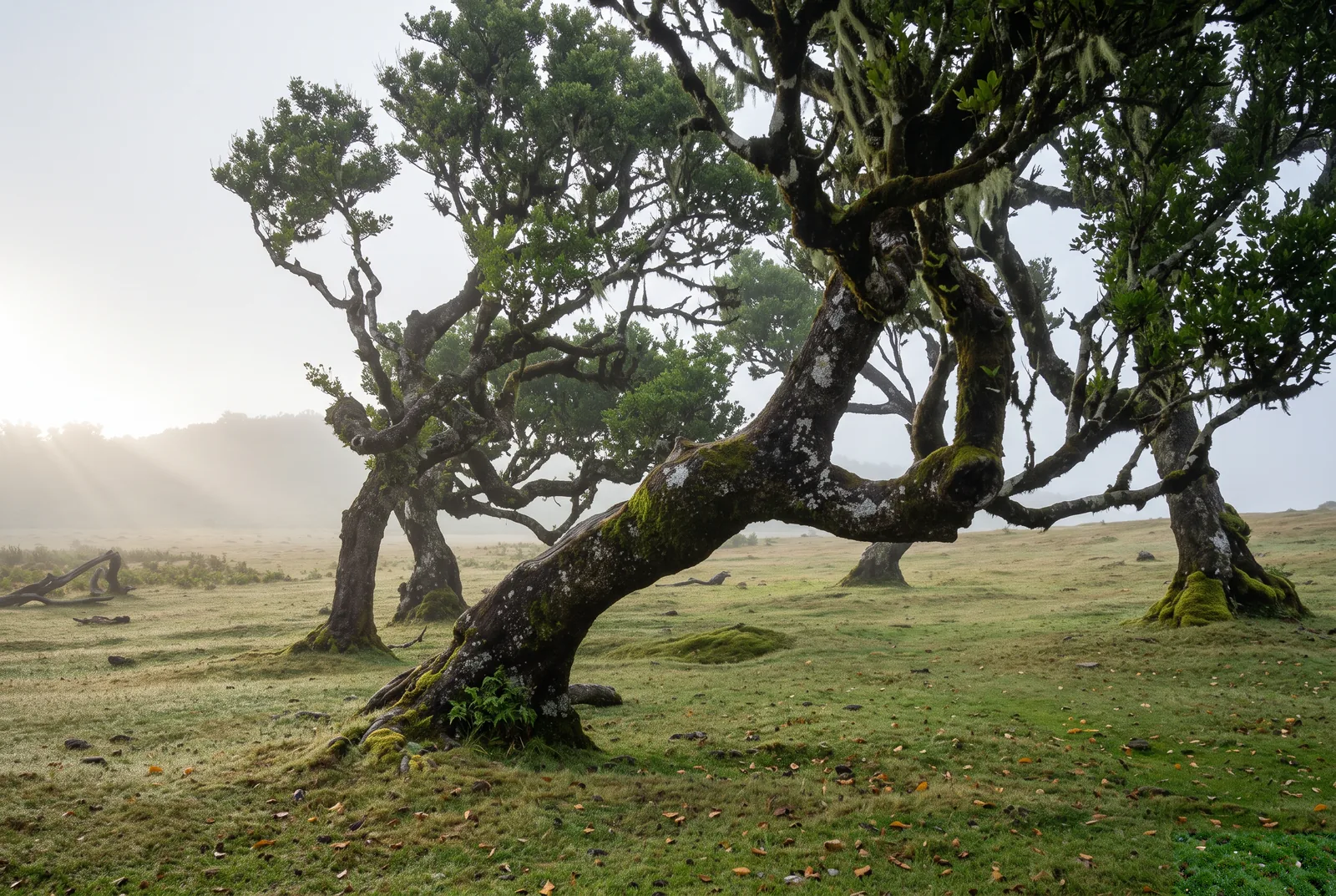
The plateau of Fanal is known for its ancient til trees standing in fog, and this is the way into that forest, rather than photographing it from the car park. The route runs 7.2 kilometres one way, descending from 1,090 m at Fanal to 840 m at Curral Falso through some of the oldest laurel forest on the island. The channel here is so old it has softened into the ground, and the path is earth, not concrete, so it holds water.
- Trail: PR14, classified.
- Distance and time: 7.2 km one way, 3 hours official.
- Altitude: 1,090 m down to 840 m, a net descent of 250 m walked in one direction.
- Difficulty: moderate, on muddy and uneven ground.
- Start and parking: Fanal, E.R. 209, finishing at Curral Falso on the same road (map).
- Fee and booking: €4.50, timed SIMplifica slot required.
- Best for: photographers, and anyone who prefers forest to viewpoints.
- Watch out: arrange the pickup at Curral Falso before you start, or you walk 7.2 kilometres back uphill.
Do not be disappointed by fog. At Fanal the mist is the show, and a clear day there is the ordinary version.
10. Levada do Caniçal: sea views on the dry east
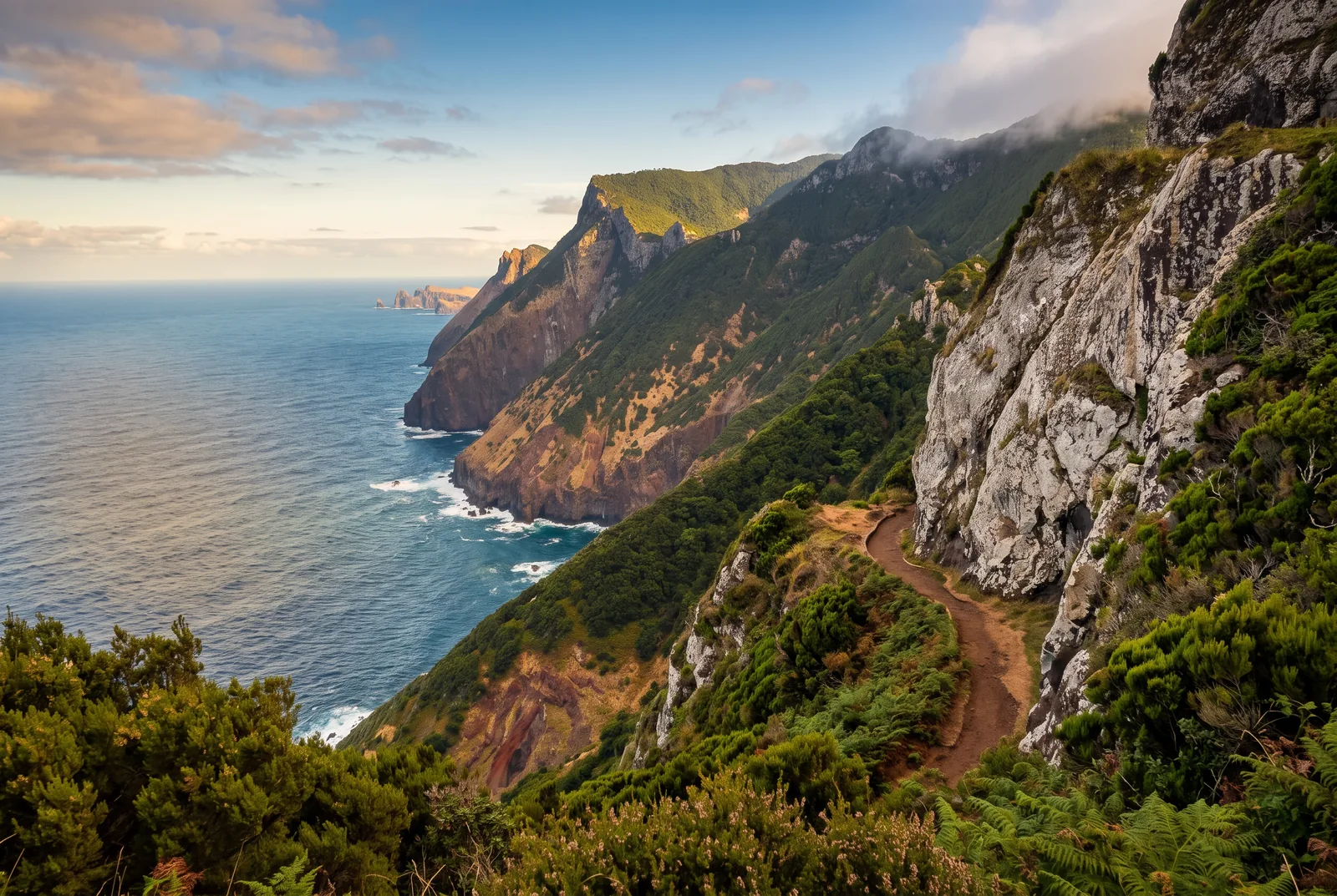
A different palette entirely. The channel threads through the hills between Machico and Caniçal, past terraced smallholdings and orchards, the bay below. Low, dry and gentle, the reliable option when the mountains are shut in cloud. A branch climbs to Boca do Risco, a breach in the cliffs where the north coast opens up, and that section is exposed and narrow.
- Trail: unclassified.
- Distance and time: your choice, out and back; allow 2 to 3 hours for a satisfying stretch.
- Altitude: low and mostly level along the channel; the Boca do Risco branch climbs steeply; no official sheet.
- Difficulty: easy along the levada. The Boca do Risco branch is not.
- Start and parking: Machico or Caniçal, roadside parking above the town (map).
- Fee and booking: none as of mid-2026.
- Best for: a low-altitude walk with sea views, and families.
- Watch out: keep Boca do Risco for a dry, calm day. The clifftop path is unfenced and the wind up there is real.
Levada walks near Funchal without a car
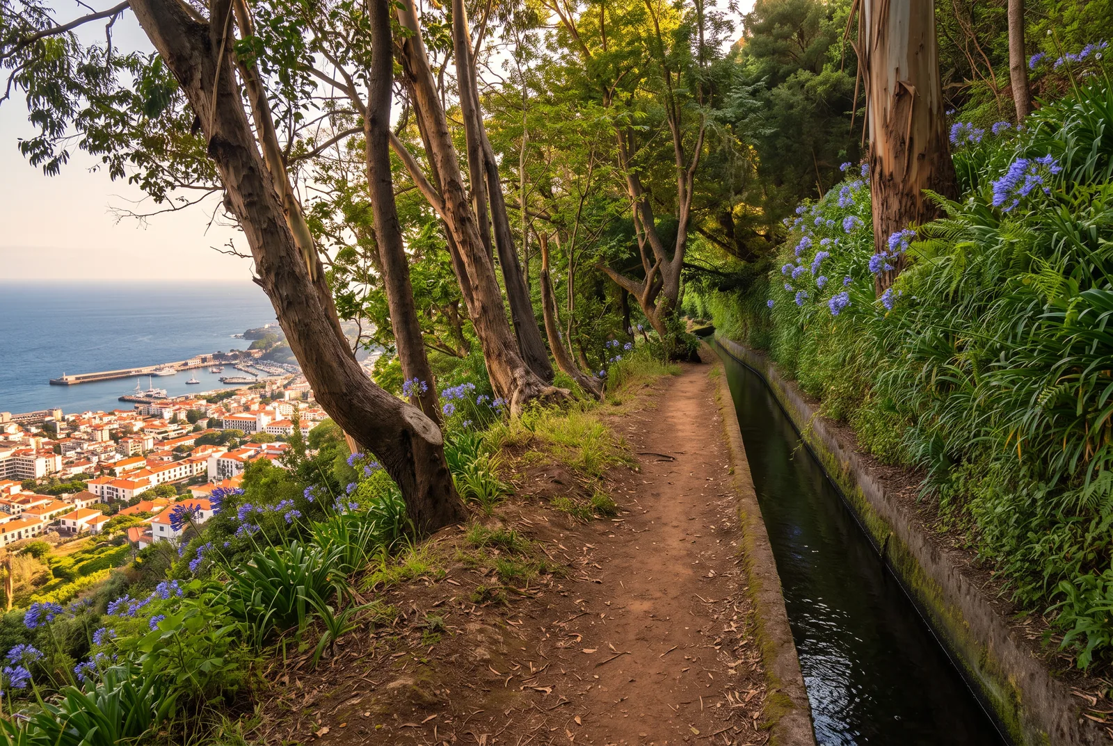
None of the ten above starts in the capital, but three genuine levadas do, and all three work as self-guided levada walks reached by cable car, bus or on foot. They carry no fee and no booking as of mid-2026, which makes these the easiest levada walks near Funchal to fit into a half day.
- Levada dos Tornos: take the cable car from the old town up to Monte and follow the levada east past Palheiro towards Camacha, stopping at one of the tea houses on the way. Return by local bus.
- Levada dos Piornais: the west-side levada above the Lido and São Martinho, minutes on foot from the hotel zone. The eastern stretch is easy and panoramic over the Socorridos valley; turn around before the exposed final section with tunnels.
- Levada do Norte: a short bus ride to Estreito de Câmara de Lobos, then a gentle walk through vineyards with amphitheatre views over the sea.
Staying in Funchal makes all three doable before lunch. Our apartments in Funchal put you minutes from the trailheads, and the beachfront penthouse sits in the Lido quarter right by the Piornais levada.
They also solve the end of the day. Walk the Piornais in the morning and you are back at the Lido seafront for a swim and a seafood lunch; after Tornos, an evening in town pairs with our Funchal food guide.
Trail fees and booking in 2026
The biggest practical change in years arrived on 1 January 2026: Madeira's classified walking trails, the numbered PR routes, now require an advance booking with a timed entry slot on the regional government's SIMplifica platform. You choose your trail, date and a 30-minute arrival window, pay online, and receive a QR code that rangers scan at the trailhead. Paid access is not new, charging began in 2024, but the timed slots and the current prices took effect on 1 January 2026.
- Standard classified trail: €4.50 per visitor over 12, per trail.
- PR1: Pico do Areeiro to Pico Ruivo costs €10.50, reflecting the rebuild of the island's most famous ridge walk.
- With a guide: operators holding an IFCN protocol pay a reduced €3 per hiker, 7 for PR1, usually folded into the tour price.
- Passes: €9 for 1 day, 22.50 for 3 days, 52.50 for 7 days, good value from two classified walks upwards. PR1 sits outside the passes and always needs its own booking.
- Exemptions: children aged 12 and under walk free but must be included in the booking; Madeira residents are exempt from payment but still register.
- Fines: forest police check QR codes at busy trailheads and issue €50 fines on the spot, with heavier penalties available for serious infractions.
Enforcement is real. Regional press reported 43 fines for non-payment between early April and mid-May 2026, out of more than 5,500 walkers checked. Of the walks in this guide, eight need a booked slot: 25 Fontes, Risco, Alecrim, Caldeirão Verde, Rei, Furado, Cedros and Balcões, which is classified as PR11 and priced at the full €4.50 despite taking ninety minutes. The Ponta do Sol loop, the Caniçal levada and the three Funchal walks sit outside the system and remain free.
What guests get wrong about levadas
These are the five things I end up correcting most often.
- That they are all easy: some genuinely are. Others are long, narrow or demanding for anyone not used to walking. Narrow ledges, wet ground, tunnels and stretches that need constant attention mean ten kilometres on a levada feel nothing like ten kilometres on a road. Do not judge a route by distance and elevation alone.
- That the Funchal forecast applies up there: it can be sunny and over 20 degrees by the sea while the high ground has fog, rain and much colder air, so I always advise at least one extra layer and some rain protection even when the day starts bright. Footwear is the other thing people underestimate: shoes or boots with real grip make a large difference, because the ground beside the water stays damp and slippery hours after the last rain.
- That the island is small, so getting there is quick: Madeira is small on the map, but the mountain roads wind and the distances take longer than they look. At the popular trailheads, parking also gets difficult by the middle of the morning.
- That you can fit two or three into one day: technically, sometimes you can. I would not: turning a holiday into a race from trailhead to trailhead is a poor trade. Pick one good walk, do it slowly, and enjoy the region around it. Stopping to listen to the water, to look at the vegetation, or simply to enjoy the silence is part of it, and for me that is most of the difference between doing a hike and actually enjoying a levada.
- That a route you walked before is open today: weather, landslides and maintenance close trails temporarily. Always confirm the official status before you set out, even on a levada you know well.
What to pack and when to go
- Footwear: hiking shoes or trail runners with real tread. Concrete beside a channel is slippery when wet, and most of these paths are.
- Layers: a light insulating layer and a waterproof jacket, whatever Funchal is doing when you leave.
- Headlamp: mandatory for Caldeirão Verde and useful on the Rei. Phone light as backup only, because you need both hands.
- Water: 1 to 1.5 litres for a short walk, 2 or more for Caldeirão Verde or the Furado. Something salty with it.
- Offline maps: signal disappears in the deeper valleys and in every tunnel. Download the island first.
- Cash in coins: the Rabaçal shuttle and some mountain cafés may not take cards.
- Trail ticket: the SIMplifica QR code, saved offline or printed. Most trailheads have no signal to load it.
- Sun protection: hat, sunglasses and SPF for the Ponta do Sol and Caniçal levadas, where shade is short.
- Poles: optional, useful on the Cedros descent and on the Lagoa do Vento reclimb.
Spring, March to May, is the best window: full waterfalls, fresh growth, comfortable temperatures. Autumn is similar with fewer people. Summer suits the high routes, because altitude does the cooling, but the Ponta do Sol and Caniçal levadas get hot. Winter is walkable and often empty, with more rain, more cloud at altitude and more closures. Our guide to Madeira in November covers what the weather really does that month.
Four habits are worth the trouble. Tell someone where you are going and when you expect to be back, because valleys swallow phone signal. Never enter a tunnel without a working light. Never pass a barrier or a closed sign, because closures mark real rockfall or a washed out ledge. After heavy rain, give steep sided routes a day to drain. The European emergency number 112 works across the island.
Getting to the trailheads
A rental car lets you start at eight in the morning, which matters more than any other logistical decision here. The roads are good but narrow and steep, and mountain fog is normal. A taxi transfer solves the point to point walks, the Furado and the Cedros above all, where the finish is nowhere near the start. A guided walk removes the parking problem and includes the fee at the reduced guided rate.
- Rabaçal: plateau car park, fills early in season, with overflow areas nearby. A shuttle minibus runs the 2 kilometres down to the forest house for a few euros each way, and cash is the safe bet. On foot it is about twenty minutes down and half an hour or more back up.
- Ribeiro Frio: a handful of roadside spaces serve both Balcões and the Furado. Arrive early or come on a tour.
- Queimadas: small paid car park, €2 an hour, at the end of a narrow, partly cobbled road above Santana. The thatched park houses at the trailhead sell coffee.
- Ponta do Sol: park in the village and start on foot. There is no single official trailhead.
- Fanal: a modest parking area serves the plateau, calmest before and after the midday tour bus window.
Without a car the picture is uneven. Intertown buses pass Santana and Ribeiro Frio, and the south coast towns including Ponta do Sol are well connected to Funchal, but schedules are sparse. No regular bus serves Rabaçal or Fanal as of mid-2026, which is why hiking shuttles have flourished, dropping you at the trailhead and collecting you at the far end. For most visitors the answer is a hybrid: shuttles or transfers for the remote west, and a base in town for the walks reachable on foot or by cable car. Our guide on where to stay in Madeira breaks down the trade-offs by area.
What is a levada and who built them
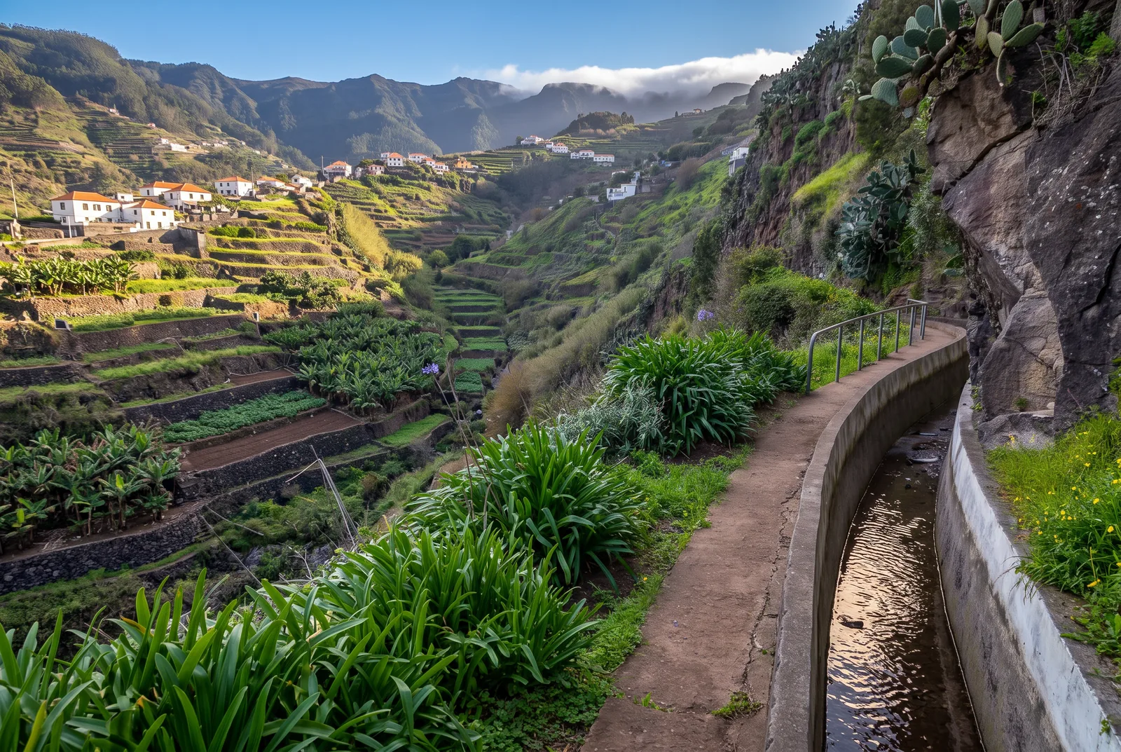
The word comes from the Portuguese levar, to carry, and that is what these channels have done since the island was settled from about 1420: move water from the rain-soaked north to the south, where sugar cane, and later bananas and vines, needed it. The oldest surviving levadas date to the sixteenth century. Long before dynamite, workers cut the channels into vertical basalt while suspended in wicker baskets on ropes, and chipped tunnels through the mountain by hand, some of the same tunnels you walk today with a headlamp.
Construction never stopped. The twentieth century added state-built channels combining irrigation with hydroelectric power, and the network now totals roughly 3,100 kilometres on an island 57 kilometres long, still working and still patrolled by levadeiros, the wardens who manage the water. The forest they cross carries its own distinction: Madeira's laurissilva, the largest surviving relic of the laurel forests that once covered southern Europe, was inscribed as a UNESCO World Heritage Site in 1999, and the levadas have been on Portugal's tentative list since 2017. See our guide to the top sights of Madeira for how they fit the island's bigger story.
Frequently asked questions about levada walks in Madeira
Are levada walks in Madeira free?
Not all of them. Classified PR trails cost €4.50 per visitor over 12, per trail, as of mid-2026, and PR1 costs 10.50. Unclassified levadas, including the Ponta do Sol loop, the Caniçal levada and the three walks from Funchal, are free. Children aged 12 and under walk free everywhere but must still be on the booking.
Do I need to book levada walks in Madeira?
For any classified PR trail, yes. Since 1 January 2026 you book a date and a 30-minute arrival window on the SIMplifica portal, pay online and carry the QR code, which rangers scan at the trailhead. Save it offline. Walkers without one are fined €50 on the spot.
What is the easiest levada walk in Madeira?
Vereda dos Balcões, at 3 kilometres return and 10 metres of altitude difference, with a view over the central peaks at the end. If you want an actual levada rather than a vereda, the Levada do Risco is 3 kilometres return on a wide, level path to a waterfall balcony, and the Levada do Rei stays almost flat across 10.6 kilometres.
What is the difference between a levada and a vereda?
A levada is a water channel, and the trail is the maintenance path running alongside it, which is why the gradient is close to zero. A vereda is a footpath, built to move people between places, so it climbs and descends as the terrain demands. Balcões is a vereda; the other nine walks in this guide follow levadas.
Can you do levada walks without a car?
Yes, with limits. The Levada dos Tornos, the Piornais and the Levada do Norte all start within reach of Funchal by cable car or local bus. Beyond that, buses reach Santana, Ribeiro Frio and Ponta do Sol on sparse schedules, but none serves Rabaçal or Fanal, so a hiking shuttle, a taxi or a guided walk is the practical answer for the west.
How many levada walks can you do in a day?
Two short ones at the same trailhead work well, Risco and 25 Fontes from Rabaçal being the obvious pair. Beyond that, I would not: turning a holiday into a race from trailhead to trailhead is a poor trade. Pick one good walk, do it slowly, and enjoy the region around it.
Plan your levada days
Book the slots the week before, check the status page the morning you go, and give each walk a whole morning. One levada done properly beats three done at speed, and the island makes that easy: pick a base and the trailheads are inside an hour's drive. Our Madeira collection puts you within reach of the mountains and a seafood lunch afterwards.
Related topics: Viewpoints, Hikes